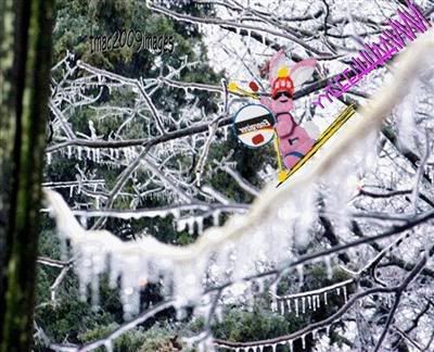
LOCKIE "ICE" LAND UPDATE..
YEEHAAWW!..
I STILL HAVE POWER!
NO POPSICLES LEFT THOUGH...
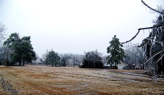
Well by some kind of miracle I have still have electricity! It is awful outside.. It has been freezing rain that only accumulates on the trees and power lines, the temperature is a constant 33 degrees. The roads are still clear though.. too strange even for me!
The governor has issued a state of emergency for my area. We are looking at snow and sleet later on tonight.. quite frankly if it doesn't stop this raining soon..and stop accumulating, everything is going to simply pop into little pieces! Snow and sleet would be a good thing, believe it or not.. it doesn't stick to trees and power lines... sigh..
The last reported amount of people without power right now stands at approx. 30,000 in my state.. I don't know what is going on in Oklahoma... but in Arkansas.. it is almost too weird to describe .
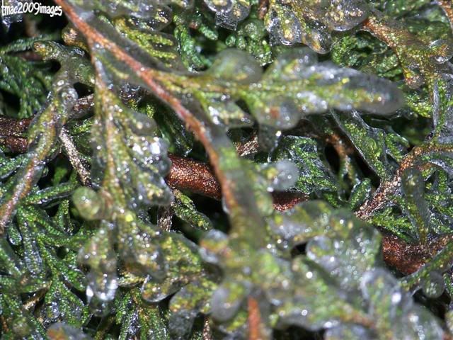
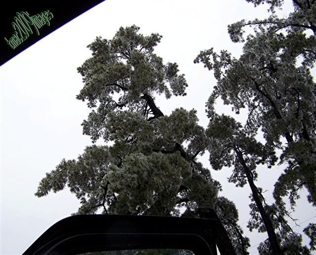
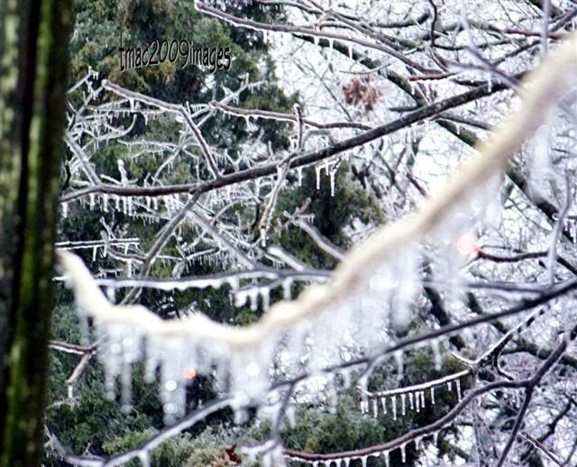
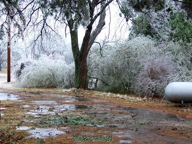
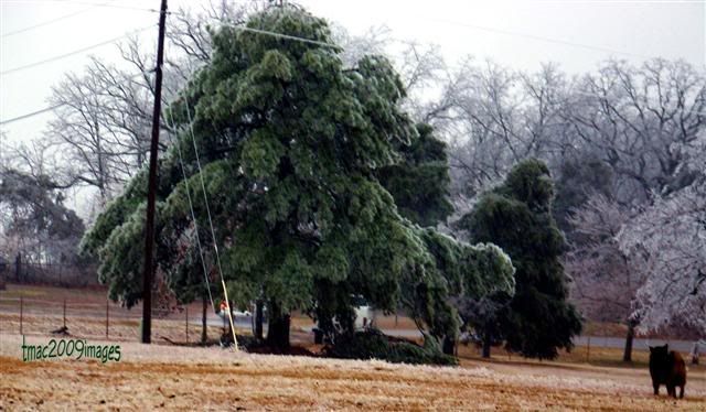
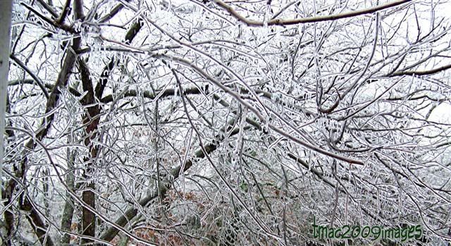
The pine and cedar trees are just like big balls of fuzzy looking ice, that are bowing down to the ground. The hard wood trees.. like oak, sweet gum, maple.. etc... look like they have been dipped in a really thick clear sealer. They are shiny and somehow magnified.. but the ground is like a flood plain.. so much water has fallen over night and during the day, the evil demon gophers, instead of dry tunnels..leading to their underground military installations, now have water flooding them and making little fountains!
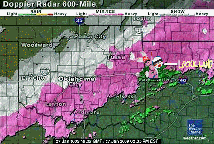
/O.CON.KTSA.IS.W.0002.000000T0000Z-090128T1200Z/BENTON-CARROLL-WASHINGTON AR-MADISON-CRAWFORD-FRANKLIN-SEBASTIAN-PUSHMATAHA-CHOCTAW-ADAIR-MCINTOSH-SEQUOYAH-PITTSBURG-HASKELL-LATIMER-LE FLORE-INCLUDING THE CITIES OF...ROGERS...BENTONVILLE...BERRYVILLE...EUREKA SPRINGS...FAYETTEVILLE...SPRINGDALE...HUNTSVILLE...VAN BUREN...OZARK...CHARLESTON...FORT SMITH...ANTLERS...CLAYTON...HUGO...STILWELL...EUFAULA...SALLISAW...MCALESTER...STIGLER...WILBURTON...POTEAU1249 PM CST TUE JAN 27 2009...ICE STORM WARNING REMAINS IN EFFECT UNTIL 6 AM CST WEDNESDAY...AN ICE STORM WARNING REMAINS IN EFFECT UNTIL 6 AM CST WEDNESDAYFOR THE FOLLOWING COUNTIES...IN ARKANSAS...BENTON...CARROLL...WASHINGTON...MADISON...CRAWFORD...FRANKLIN...SEBASTIAN.IN OKLAHOMA...PUSHMATAHA...CHOCTAW...ADAIR...MCINTOSH...SEQUOYAH...PITTSBURG...HASKELL...LATIMER...LE FLORE.FREEZING RAIN...OCCASIONALLY MIXED WITH SLEET...WILL CONTINUE TODEVELOP AND MOVE ACROSS EAST CENTRAL OKLAHOMA...NORTHWEST AND WESTCENTRAL ARKANSAS TODAY. TOTAL ICE ACCUMULATIONS BETWEEN A HALF ANDONE INCH ARE LIKELY THROUGH TONIGHT...WITH LOCALLY HIGHER AMOUNTS.TEMPERATURES REMAIN BELOW FREEZING NORTH OF WILBURTON...FORTSMITH...MOUNTAIN TOP LINE. SIGNIFICANT ICE ACCUMULATIONS ARE LIKELYNORTH OF THIS LINE THIS AFTERNOON AND EVENING. ALTHOUGHTEMPERATURES REMAIN ABOVE FREEZING ACROSS FAR SOUTHEAST OKLAHOMAAND WEST CENTRAL ARKANSAS...TEMPERATURES ARE EXPECTED TO FALLBELOW FREEZING THIS AFTERNOON WITH SOME ICE ACCUMULATIONS LIKELYINTO THE EVENING HOURS.THE FREEZING RAIN WILL BECOME INCREASINGLY MIXED WITH SLEET ACROSS EAST CENTRAL OKLAHOMA AND NORTHWEST ARKANSAS THIS AFTERNOONINTO THE EVENING HOURS. PRECIPITATION WILL BEGIN TO TAPER FROMNORTHWEST LATER TONIGHT...BEFORE ENDING ACROSS THE AREA BYWEDNESDAY MORNING.SCATTERED POWER OUTAGES HAVE ALREADY BEEN REPORTED ACROSS THEAREA. ADDITIONAL ICE ACCUMULATION ON TREES AND UTILITY LINES ISEXPECTED...WHICH WILL RESULT IN MORE WIDESPREAD OUTAGES. IN THEHARDEST HIT AREAS...THE OUTAGES COULD LAST SEVERAL DAYS ANDPOSSIBLY AS LONG AS A FEW WEEKS.