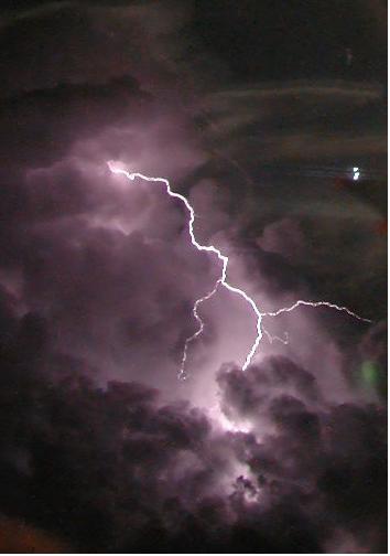
Well according to my weather caster here in Lockie Land.. it is coming at me.. will be here sometime around 6 a.m. in the morning.. sigh.. I mean good grief! Can we have just a little break here in between the ice storms and the tornado touch downs.. the hail bombings.. and wind gusting? I suppose not.. sigh.. lol.. I know you are probably thinking.. stop your whining woman.. it is just mother nature changing clothes for the next season.. but I had one heck of a year for weather related stuff last year and I just wish we could have a month or so of calm and nice before we hit the big time again! Last year we had a doozy of a time of it, and I am really pretty nervous about this spring for sure. I put together a movie of what hit us last year and because I was not so knowledgeable about how these things work on the internet.. lots of folks didn't have the opportunity to see it because their computers wouldn't play it for them. Since then, I have gotten a bit more educated about things and I am posting it again. I hope it is viewable by everyone this time. Once you see it, I think you will understand why I am a wee bit nervous about it happening all over again. So in lieu of me prattling on and on.. here is the video and my current weather forecast for tonight and tomorrow.
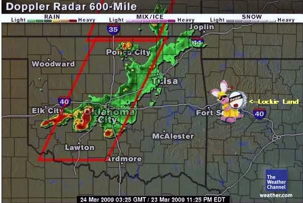
This is the radar that is coming at me.. and more behind it..
Crawford (Arkansas)SHORT TERM FORECASTNATIONAL WEATHER SERVICE TULSA OK956 PM CDT MON MAR 23 2009ARZ001-002-010-011-019-020-029-OKZ049-053>076-240400-BENTON-CARROLL-WASHINGTON AR-MADISON-CRAWFORD-FRANKLIN-SEBASTIAN-PUSHMATAHA-CHOCTAW-OSAGE-WASHINGTON OK-NOWATA-CRAIG-OTTAWA-PAWNEE-TULSA-ROGERS-MAYES-DELAWARE-CREEK-OKFUSKEE-OKMULGEE-WAGONER-CHEROKEE-ADAIR-MUSKOGEE-MCINTOSH-SEQUOYAH-PITTSBURG-HASKELL-LATIMER-LE FLORE-956 PM CDT MON MAR 23 2009.NOW...AT 9:45 PM...NATIONAL WEATHER SERVICE DOPPLER RADARS INDICATED ALINE OF SHOWERS TO STRONG THUNDERSTORMS ACROSS NORTHEASTOKLAHOMA...NORTH OF INTERSTATE 44...AND EXTENDED BACK INTOSOUTHWEST OKLAHOMA AHEAD OF A COLD FRONT AND DRY LINE. SOME OFTHESE THUNDERSTORMS HAVE BECOME SEVERE WITH THE POSSIBILITY OFLARGE HAIL AND VERY STRONG WINDS. THESE SHOWERS AND THUNDERSTORMSWERE MOVING TO THE EAST AND NORTHEAST AT AROUND 40 MPH.THROUGH 11 PM...SHOWERS TO STRONG THUNDERSTORMS WILL CONTINUE TOSPREAD ACROSS NORTHEAST OKLAHOMA AS THE COLD FRONT OVERRUNS THEDRY LINE AND PUSHES TO THE EAST. LOCATIONS TO BE AFFECTED WILL BETHOSE MAINLY ALONG AND NORTH OF INTERSTATE 44. HEAVYRAINFALL...STRONG GUSTY WINDS...SMALL SIZE HAIL AND DANGEROUSCLOUD TO GROUND LIGHTENING COULD BE POSSIBLE WITHIN THETHUNDERSTORMS...WITH THE POSSIBILITY OF BECOMING SEVERE.A TORNADO WATCH IS IN EFFECT UNTIL MIDNIGHT CDT TONIGHT FORCREEK...TULSA...OSAGE...PAWNEE...ROGERS AND WASHINGTON COUNTIES INNORTHEAST OKLAHOMA
.AND THAT IS THE WORLD ACCORDING TO LOCKIE THIS MARCH 23, 2009... HOW IS IT IN YOUR LITTLE CORNER OF THE EARTH?